
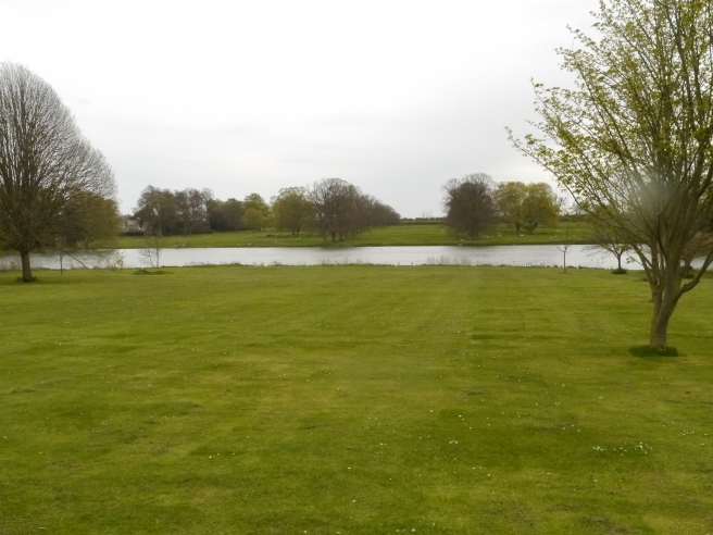
As part of the Medieval Settlement Research Group weekend we went to look at the remains of Riseholme deserted village to the north of Lincoln as the last part of the conference. Risholme Hall and the surrounding grounds are owned by the University of Lincoln and have been converted into University buildings and training facilities. The Hall itself dates from the 19th century (rebuild of an earlier structure) and the area around the hall has been landscaped including the creation of a lake to the south of the hall. Further to the south, across the lake are the remains of the deserted village.
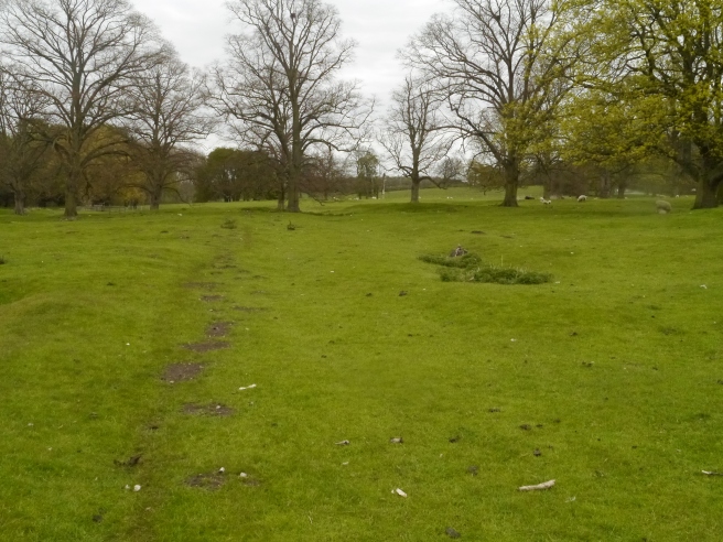
The remains of the village have been investigated on a number of occasions. Survey and excavation at the site were conducted in 1954 and 1955 (Thompson 1960), and a fuller and more detailed survey was undertaken by the RCHME in 1990s (Everson et al 1991). On the ground the earthworks are still visible and some of the pattern of the settlement can be easily discerned. A hollow way crosses the site from the southwest in a north-easterly direction. On either side of this are a number of crofts and tofts. Those to the south of the hollow way are more regular in appearance but this may be due to the northern ones being affected by upcast from the creation of the lake. This would suggest some form of planning in the layout of the settlement.
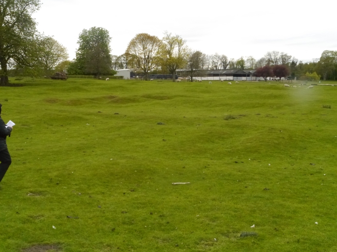
The site of Riseholme village is recorded as being ruined in 1602 and the church (located near the hall) had also suffered by this point. This was the end of a slow decline as there were fewer than 10 households recorded in 1428. The excavation at the site concentrated on one of the possible house sites along the hollow way (called House 4) and the site of a well. The house excavation located evidence of a structure – in some places indicated by the presence of walling, in others the presence of robber trenches. The evidence suggested that there were two rooms in the building, one had a stone floor and the other a mortar floor. Pottery recovered from under the floor and walls suggested a thirteenth century date for construction, and a coin of Edward I along with the absence of later pottery have suggested a fourteenth century abandonment.
The excavation of the well was halted when the water level was reached but no pottery later than fourteenth century was recovered. In the report on the excavations only 13 sherds of pottery are listed and it is unclear how much pottery was recovered in total from the excavations and this would be well worth revisiting to establish if such a clear distinction can be made with no later pottery discovered.
The site at Riseholme is complex. The neat earthworks of the village visible today may not be the only settlement at the site. These are some distance from the church, next to the hall. This is assumed to be the location of the medieval church. Earthworks do show hollow ways linking the village area to the church and a possible grange site to the east. There are suggestions therefore that there was another part of the medieval settlement located close to the church and hall site – possibly the medieval manorial centre of the estate.
This is a site which in many ways is a ‘typical’ DMV – neat hollow way with house plots either side – but dig a little deeper and the story becomes more complex. It would be an ideal site to reinvestigate to review the site as a whole, in its landscape, and to try to establish the true settlement development of the area.
References
Everson, P., C. Taylor and C. Dunn 1991. Change and Continuity: Rural Settlement in North-West Lincolnshire. London: HMSO.
Thompson, F.H. 1960. The deserted medieval village of Riseholme, near Lincoln. Medieval Archaeology 4: 95-108.
